Undesign (and Understand) the Redline

undesign the redline.png

The Wymer's DC team is excited to announce that it is featured in this month's exhibit, Undesign the Redline, at the Pepco Edison Place Gallery. This phenomenal exhibit was created and curated by designing the WE and their sponsorship partners (Enterprise; District of Columbia Housing Finance Agency; Georgetown University, School of Continuing Studies, Urban & Regional Planning; and Klein Hornig, LLP).

designingthewe.png

Undesign the Redline is a traveling exhibit which explores the history of the practice of redlining across the country. What is Redlining? In this case, it does not refer to the Metro line, as some Washingtonians might believe. The exhibit says it best:

Coined by sociologist and community activist John McKnight in the late 1960s, Redlining refers to the practice of denying loans or services to an area based in some part on its racial and ethnic composition. Redlining limited who could build wealth through home-ownership for generations. While its roots are traced to New Deal policies, the practice continued legally into the 1970s. Even after the passage of the Community Reinvestment Act of 1977, banks continued to engage in the practice... Dr. Mindy Fulilove refers to the suppressed history of Redlining as a 'Rosetta Stone' for understanding the current societal crises.

Check out the Undesign the Redline webpage to learn more! Also, check out these awesome digital humanity websites (Mapping Inequality and the National Community Reinvestment Coalition's Redlining Map ) which plot Redlining data for cities across the country.

How does this connect to Wymer's DC? Redlining data is usually visualized through HOLC (Home Owner's Loan Corporation) maps. Starting in 1935, 239 cities across the country (including D.C., Baltimore, and Richmond) were mapped indicating the economic risk of real estate development in various neighborhoods. The areas of "highest risk" were African American neighborhoods.

Although the HOLC maps were declassified in the 1990s, the map for D.C. has not turned up. designing the WE learned about the John P. Wymer Photograph Collection through Wymer's DC and thought it would be the perfect proxy for the city.

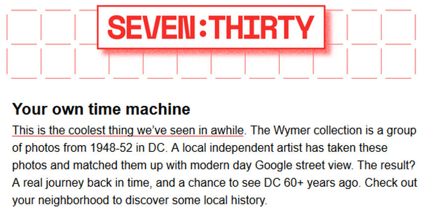
This collection of approximately 4,000 photographs, taken by John P. Wymer between 1948 and 1952, provide a relatively unbiased, yet systematically documented view of the city. Wymer's hand-drawn maps and descriptions of the neighborhoods he visited help tell the story that is missing with the loss of the HOLC map for D.C. His pictures provide a visual aid to the areas he describes.

Learn more about Wymer's documentation practices here. The John P. Wymer Photograph Collection is owned by the Historical Society of Washington, D.C. Images may not be reproduced without their permission.


pepco.jpg

Be sure to check out
Undesign the Redline!

The show runs through September 28, 2017!
The Pepco Edison Place Gallery (702 8th St NW)
is open to the public Tuesday - Friday from 12 - 4pm.


Autumn 2016 with Wymer!

Wymer's DC is active once again after a three month hiatus!

We will be regularly updating the site as well as fixing error submissions sent in by our users. Jessica Smith, the creator of Wymer's DC will be speaking the at the Annual Conference on D.C. History of November 4th if you are local and want to learn more.

As a reminder, while the Wymer collection is 4,000 images, only 2,300 of those are available for use in this project because those are the only ones which have been scanned in high resolution. The remaining 1,700 Wymer images are available to see only in person at the Historical Society of Washington, D.C. (HSW).

For those of you familiar with the collection, you may have seen Wymer images in person that will not be used on this site simply because they haven't been scanned. As more Wymer images are scanned at HSW, we will add those images to our bank and continue to update the site.
~~~
Are you interested in being a volunteer on this project? There are several volunteer tracks which anyone can participate in remotely. All that's needed is a computer and internet access. Contact WymersDC@gmail.com for more information.

Check out the previous post for more information on the site and its creation.

May 2016 - Progress and Future Updates

Thank you for visiting Wymer's DC! It is our hope that this website will be an avenue for all interested parties to explore DC and learn about this city's history. 

A few notes as you start exploring the site -

1. The interactive map does not yet host all of the 4,000 Wymer images. Only 2,300 of the Wymer images have been scanned for digital use and those are the ones which will appear on the map by the middle of May 2016. At this time (May 2), approximately 1,700 images are hosted on the map.

The images are scanned ad hoc based on patron request from the Historical Society of Washington, DC. If no patron has requested a digital scan of a particular Wymer image, it has not yet been scanned. This is why some areas have a denser concentration of photographs than others, as it is based entirely on requests.

As the Historical Society scans more and more images, this site will be updated in batches in the coming months.

2. The the mapping interface is still a work in progress. By the end of May 2016, the website will be complete regarding the 2,300 scanned images. The map that is viewable now hosts 1,700 images, but many of them have not yet been refined in terms of positioning and scale.

Please check back with us at the end of the month to see the progress that has been made.

3. This project is intended to be a community effort. If you see an error on the map, please submit your findings via the form on the contact page and the information will be updated. We value your help improving this site for everyone to use.

4. There are ways for you to get involved in this project and others like it, such as photographing new areas not covered in Google Street View, reviewing current image placement for accuracy, publicizing this website, providing funding for scanning the remaining Wymer images, etc.

If you are interested in helping this non-profit research tool, please get in touch via the form on the contact page or send an email directly to WymersDC@gmail.com

We welcome your comments and feedback.

Thank you for helping to improve Wymer's DC!