Maps and Area Descriptions
As part of this photography project, John Wymer divided the city into 57 roughly equal areas and then photographed a sample block from each. For each area, he produced a hand-drawn map as well as a summary of his reflections on the area. This page contains those maps and area descriptions.
In the descriptions, his choice of language is an authentic representation of the attitudes of some people in the mid 20th century. Much can be learned about the frame of mind of middle class, white, urban Americans by reading his text. These descriptions and photographs are a brief, but immersive glimpse into how Wymer viewed the people and city of Washington, DC. To read more of Wymer's writing, visit the 'In his own words' page.
To navigate this section quickly, click on the hyperlink for the area you want to jump to that section.
1 / 2 / 3 / 4 / 5 / 6 / 7 / 8 / 9 / 10 / 11 / 12 / 13 / 14 / 15 / 16 / 17 / 18 / 19 / 20 / 21 / 22 / 23 / 24 / 25 / 26 / 27 / 28 / 29 / 30 / 31 / 32 / 33 / 34 / 35 / 36 / 37 / 38 / 39 / 40 / 41 / 42 / 43 / 44 / 45 / 46 / 47 / 48 / 49 / 50 / 51 / 52 / 53 / 54 / 55 / 56 / 57
City Map

The areas of the city, as divided by Wymer. Image courtesy of the Historical Society of Washington, DC
Area 1

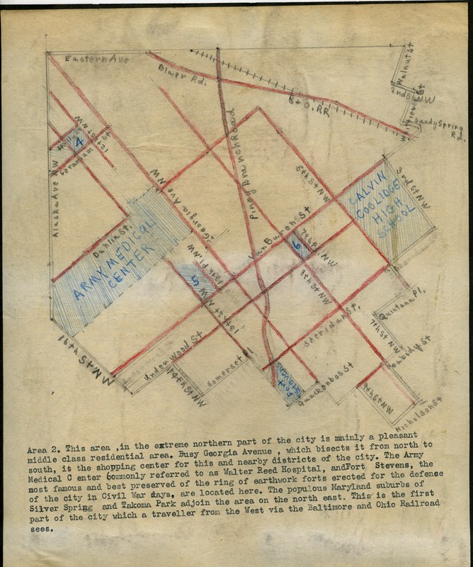
Area 2
Area 3

Area 4

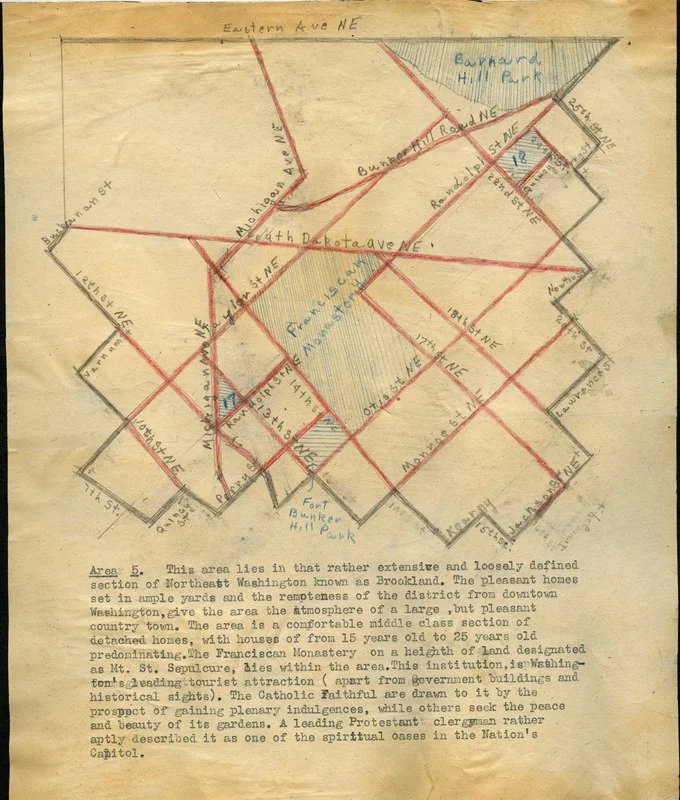
Area 5
Area 6

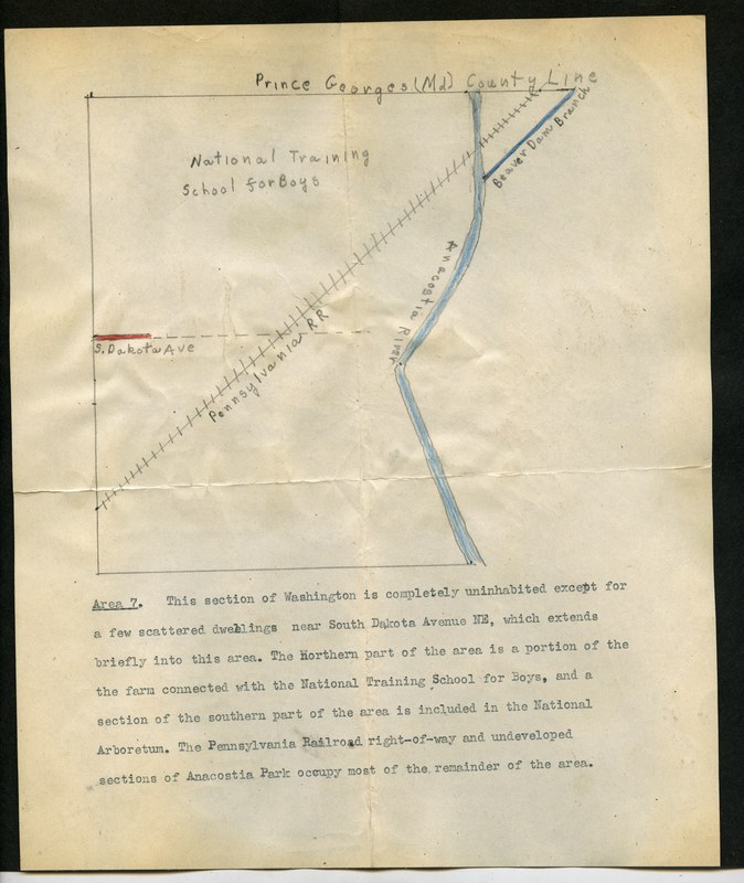
Area 7

Area 8

Area 9

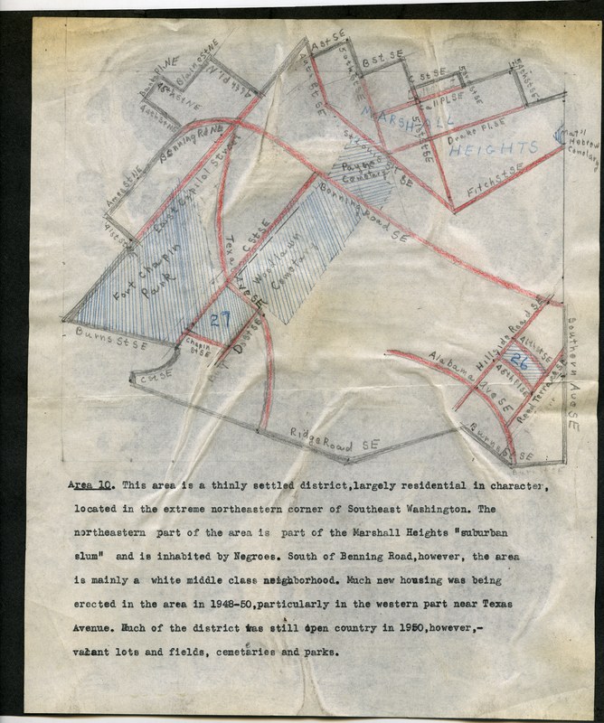
Area 10

Area 11
Area 12
Area 13
Area 14
Area 15
Area 16
Area 17
Area 18
Area 19
Area 20
Area 21
Area 22
Area 23
Area 24
Area 25
Area 26
Area 27
Area 28
Area 29
Area 30
Area 31
Area 32
Area 33
Area 34
Area 35
Area 36
Area 37
Area 38
Area 39
Area 40
Area 41
Area 42
Area 43
Area 44
Area 45
Area 46
Area 47
Area 48
Area 49
Area 50
Area 51
Area 52
Area 53
Area 54
Area 55
Area 56
Area 57

The images of this page are part of the John P. Wymer Photograph Collection; copyright is held by the Historical Society of Washington, DC.